多源时序国产卫星影像的森林火灾动态监测
Forest Fire Dynamic Monitoring based on Time Series and Multi-source Satellite Images: A Case Study of the Muli County Forest Areas in Sichuan Province
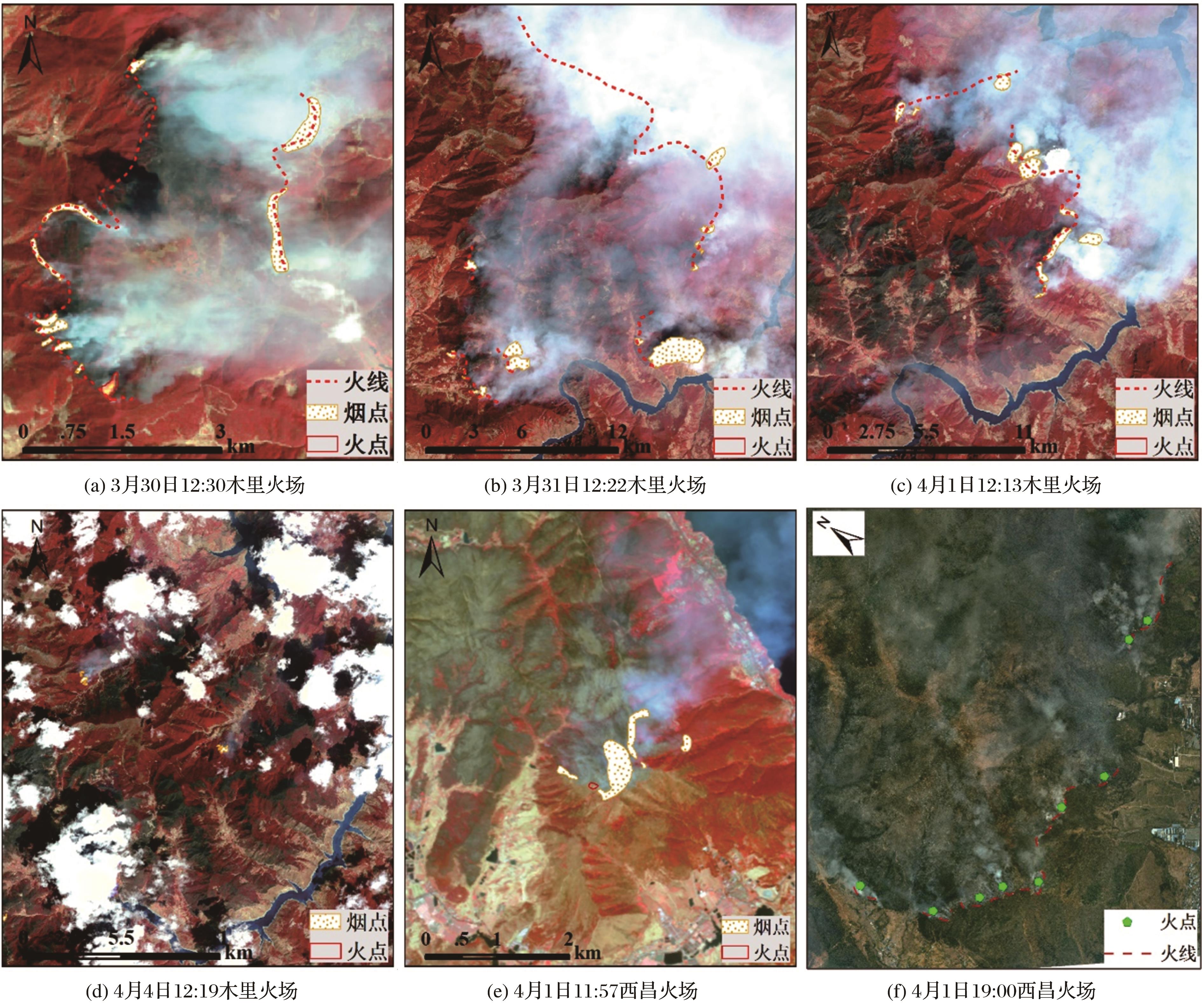
(图3(a)~(e):2 m/8 m光学卫星星座波段4、3、2合成假彩色影像,图4(f):无人机RGB航摄影像)
多源时序国产卫星影像的森林火灾动态监测 |
| 曾超,曾珍,曹振宇,邹强,余长锡 |
|
Forest Fire Dynamic Monitoring based on Time Series and Multi-source Satellite Images: A Case Study of the Muli County Forest Areas in Sichuan Province |
| Chao Zeng,Zhen Zeng,Zhenyu Cao,Qiang Zou,Changxi Yu |
| 图3 基于卫星和无人机航空影像的林火热点目视解译结果 (图3(a)~(e):2 m/8 m光学卫星星座波段4、3、2合成假彩色影像,图4(f):无人机RGB航摄影像) |
| Fig.3 Visual interpretation of forest fire hot spots based on satellite and UAV images |
|
|